Wednesday, August 9, 2017
Tuesday, October 27, 2015
Our 2015 Western USA Trip

Our 2015 Western USA Trip.

In 2015 Robin wanted to take a longer more interesting vacation and see some places we hadn't seen in a number of years, along with some we've never made it too.
The initial plan was to revisit Sequoia National Park and Yellowstone National Park. I said if we're going to Yellowstone we should go on over to the Black Hills of South Dakota and see Mt Rushmore.
While making our reservations we discovered the time we would be in Rapid City would coincide with the 75th anniversary of the annual Sturgis motorcycle rally. So we pushed our trip back a couple weeks, by spending a week in Oregon and in Washington State.
We also wanted to ride the Cumbres and Toltec narrow gauge historic railroad in southern Colorado and northern New Mexico. Then down to Carlsbad Caverns in New Mexico. The rest was a matter of just connecting the dots!!
Here's a Google Map of our proposed trip.
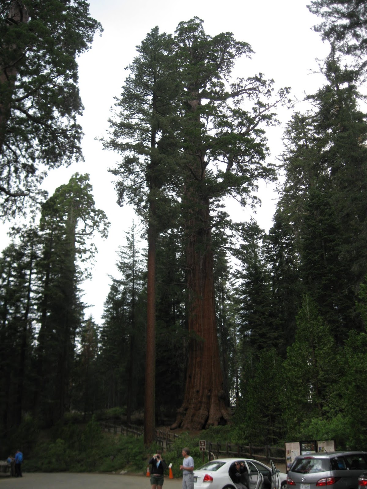
Our trip started with a revisit to Sequoia National Park

Here's our Campground, about in the middle of the park.

Here's our campsite!

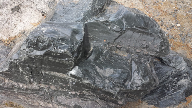
Just an interest rock formation, kinda looks like a puzzle!

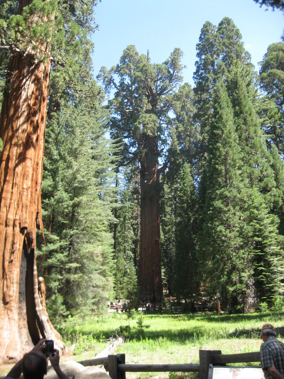


Whats a trip to the Sequoias with out driving through a tree.

Will I fit?


So many great trees.


A young bear in a meadow close to our campgrond.
 Having a little breakfast


Our 2015 Trip to Jackson, CA.
Each year we try to visit our long time friends in Jackson, Ca.
Jackson Rancheria Casino Resort and Gold Country RV Park.

Well this trip we stayed at Gold Country, because Rancheria had no vacancies.
 Here's our space right in the middle of the park
 Nice in the middle of the week, no neighbors!!
 Nice and shady most of the day.
After a real nice visit with our friends it was time to continue on north. We had reservations in Red Bluff, but when we got there at about noon it was 95* and we decided to keep driving north and a cooler location.
We got to Mt Shasta city by 2:00 and about 20* cooler. We called and got a reservation at Adams Lake RV park.
 Mt Shasta in the distance.
 Another shot of Mt Shasta.
 Our spot at Adams Lake RV park. Real nice, quiet and lots of tall pine trees.
 Walking around Adams Lake we found some Poison Ivy!!
 Lot of young trees.


 While driving we found another nice lake!

 Nice part of the state!
On to Oregon and the Summer Lance Rally!
(see separate page)
After the rally we moved on to La Pine a small town about 20 miles south of Bend, Oregon.
We had reservations at
 Leaving Mt Shasta area and we saw this Water Truck sales along the interstate.
 Just about every color you can think of.
 Neat!
Neat!
 One of the last California towns before we get to Oregon.
 There you go we've made it to Oregon.
For the Summer Oregon Lance Rally
it on it's own page.
After the Oregon Lance Rally we had a reservation at Cascade Meadow RV Resort. It just outside of La Pine and 20 miles south of Bend.
 Here's our space!
Nice well maintained grass.
This is a Resorts of Distinction Resort, which we can stay at as part of our membership at Mt. Lakes Resort back home. This is a nice RV park, but the only spot in miles with no pine trees-go figure!!
Here's our space!
Nice well maintained grass.
This is a Resorts of Distinction Resort, which we can stay at as part of our membership at Mt. Lakes Resort back home. This is a nice RV park, but the only spot in miles with no pine trees-go figure!!
 We used this resort as a base camp for exploring all the things central Oregon has to offer!
A day trip to the Lava Lands visitor center.
 Lava Land visitors center. Located a few miles south of Bend, Or.
 A portion of the original creator.
 A view to the northwest at Sisters mountains.
 A view of Bend off in the distance.
 Another lava dome in the distance.

A visit to the High Desert Museum.
 A graphic of the area

 An owl on the tree limb
 Bald Eagles

Close up!!
 A Hawk
 Another Owl in the shelter
 Yes, a Porcupine
 Otters in a tank, for inside the enclosure.
 Same otter above the water line.
 From outside
 A little video action of the two otters.

More Otter action

Aren't they cute!!

Ready to jump

Checking us out!!

Early Oregonians habitat.
 Early settlers
A day trip to Pauline Lake
 Real nice lake
 Great place to go fishing

A lava flow are with a glass
 A mountain of lava glass
 Stairs up the mountain of glass
 Here's a nice example of some Lava Glass
A day trip to Portland, Or.
 Beautiful drive
 Mount Hood in the distance.

 Another shot of Mt Hood


On to Boardman, Oregon
 The Dalles Bridge, 197 @ I-84


Boardman Marine and RV Park
It's an old Corp of Army Engineers/Bureau of Reclamation site. Used when the Columbia River was widened and the various damns were being built.
 This is a very beautiful RV park with very nice spaces, right on the Columbia River.
 We were at the east end and this is looking west.
 Looking south of our space.

 The Columbia canyon
 McNary Lock and Damn
 The window art is from the sprinklers at Boardman RV Park soaked our truck!!
 Umatilla Bridge from Oregon to Washington.


 McNary Lock and Damn
 There it is, Washington State.
 The Washington prairie!
Heading onto Washington State!
 Could be the mid-west if you didn't know where your at!
 More Washington prairie!
Ponderous Falls RV Resort, our second Resort of Distinction on our trip. It's also another base camp for seeing the sights in and around Spokane, Or.
 Nice water fall in Ponderous Falls
 Our spot, lots of tall pine trees!

We moved across the aisle to get a bigger space and away from the playground!

Looking up the park at other spaces.

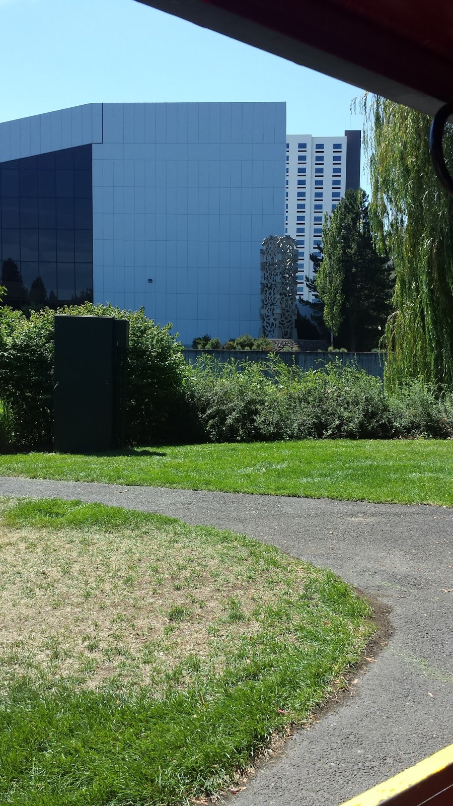
Riverfront Park in central Spokane
 Here's a picture of the river area and the old hydro power building.
 The Water falls
 A close-up
 On of the damns
 The old Monroe bridge.

A real nice fountain in the middle of the park that the kids could play like a splash pad.
 Riverfront Park Carousel
A video of the Carousel
 The Clock Tower
 A very interesting tower over the amusement area


 Early Native American Totem

 Outdoor dinning on the deck of the building in the distance!

 An iron Butterfly one of the leftover sacraments from the 1974 World Expo

A sculpture off in the distance!
 Another sculpture
 The nice little gondola ride
 A classic icon, but in giant size!!
 Dedication of the park

 Robin on the wagon slide
 Here she comes!!
 She made it!!


 More Washington prairie!


Bob on the wagon slide (after I chased a kids away!!)
 And what else would you expect in a kids city park?
 History of the park
In looking on line for points of interest and things to do, I discovered there was a Zip Line ride in a near by city. As it turned out I book us for a 10 AM ride on July 30th which turn out to be Robin's Birthday!! And a Zip Line was one of her bucket list "Things to do"!!!
The Zip Line company is called Mica Moon Zip Tours. It's on private land on Mica Mt and the property owners run the business.
 The tour consists of about 10 people, a van ride up the mountain, getting into a safety harness and another ATV ride up to the starting location. The Zip ride consisted of 8 different zip lines.
 The zip lines run from tree to tree. Each tree has a landing and take off platforms.


 There were two staff members, one would cross first, then the other would help those riding and follow us over.
 Some of the first legs were kinda short, I think to get us comfortable with the whole thing.
 Here's a picture back toward Spokane.


 Robin ready for the final ride! FUN TIME!!!
After a great week in Spokane, it's time to start working our way towards Yellowstone National Park. But first we have to travel through Idaho and Montana, so here they come!


A short distance out of Washington is the state line with Idaho.

This wasn't at our entree point, but I like the message!

Lake Coeur-dAlene-BIG!!!

Another picture of Lake Coeur-dAlene

To bad we didn't alot more time to the Coeur-dAlene area of Idaho, looks like a very nice place!

Entering Montana "Exit 0"

There's the Montana Sign on the overpass!

Time for a rest stop!

Everyone had to go!!
 Great looking Setup there!!
Our half way point to Yellowstone, in Missoula, Mt at Jim and Mary's RV Park

A beautiful part of the country!
A short video of a rain storm we went through

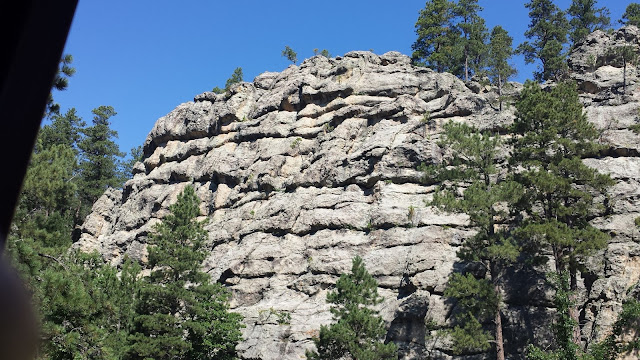
Stopped for road construction, so I was checking out the rock formations for the grandson!

A real nasty rain storm we went trough on Hwy 89 between I-90 and the north entrance to Yellowstone.

There was wind and rain like we have never encountered while towing our trailer.


Here's our camping spot in Gardner, Mt. a nice little town right on the north entrance to Yellowstone NP

Looking south from our camping spot.

Here's a panorama shot of Gardner.

Here's a panorama shot of Gardner.

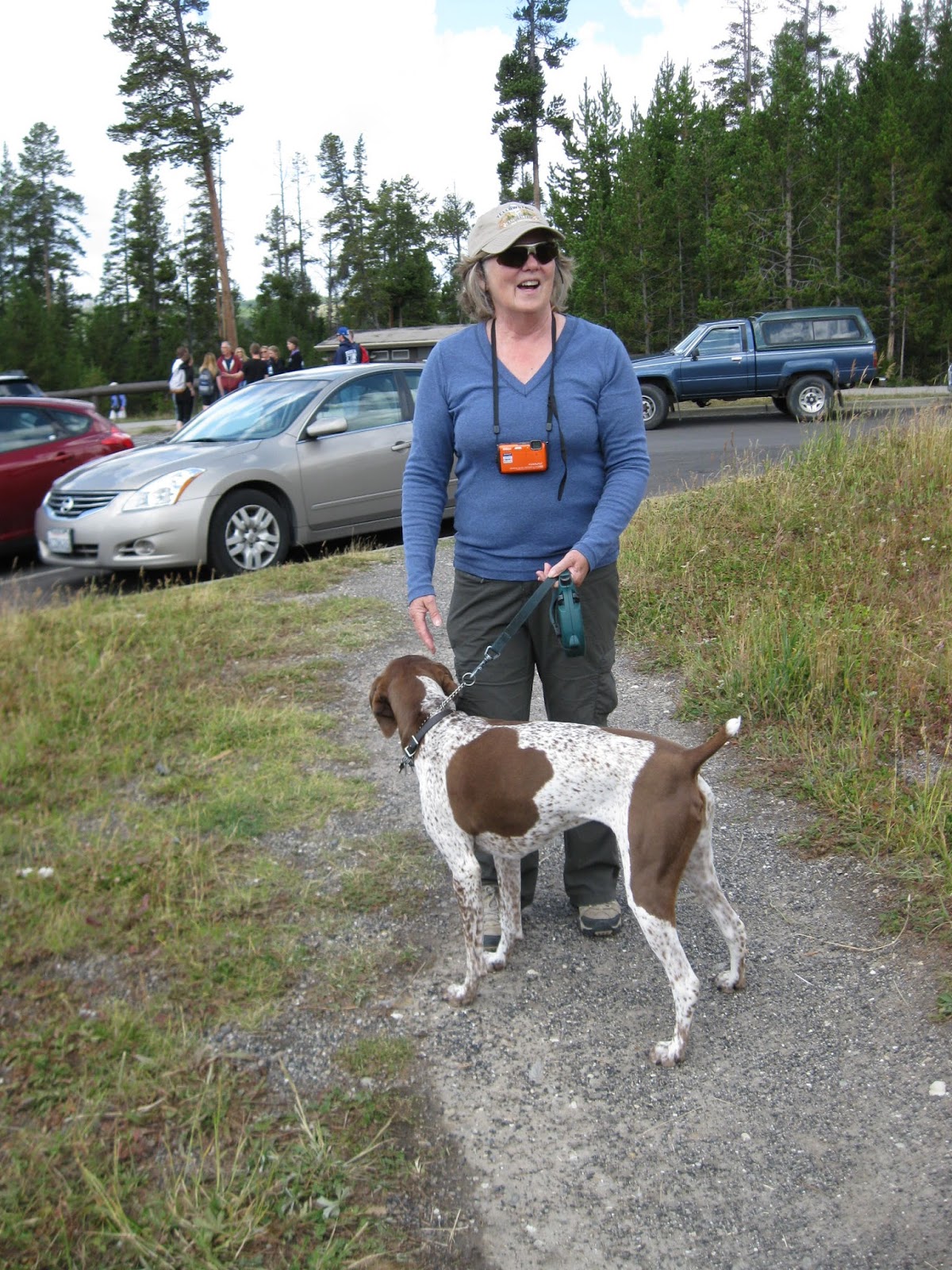
Some Elk eating down below our camp site.

Here's another picture with one elk crossing the street.
The next group of pictures are from Yellowstone the reason for this trip!


A short video, but no Aroma!


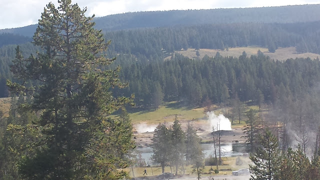
And what would be a trip to Yellowstone with some shots of Old Faithful!


 This guy just walked right out into the road, so everyone stopped and took pictures!


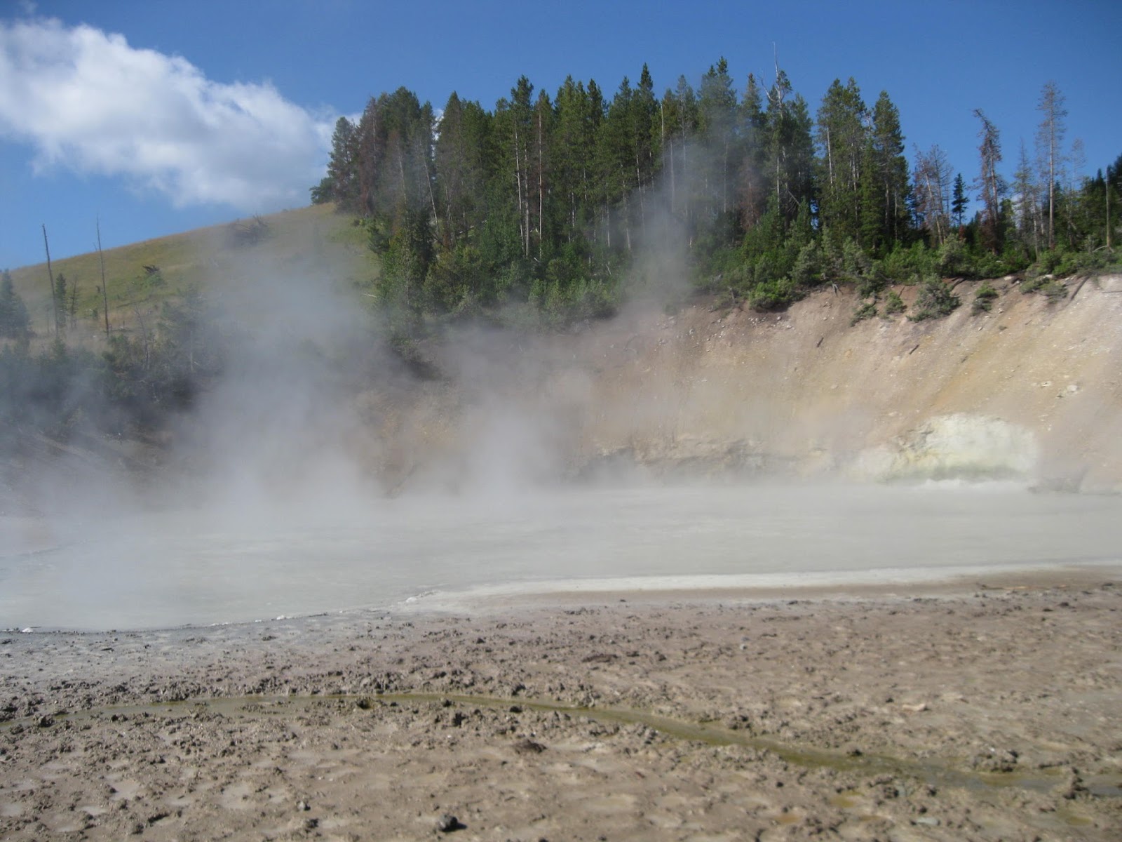
Yellowstone Little Grand Canyon.


 Yellowstone Grand Canyon.


 More of Yellowstone Grand Canyon.
Here's our Fishing Bridge RV Park.
 More of Yellowstone Grand Canyon.
 Looking up our aisle, our Lance in the corner.

 Looking down our aisle. kinda empty right now, but it filled up before we pulled out. The campground was in very poor condition and I turned in a complaint to the Park service.
 There's our rig and campsite!


 This is one of the oldest building in the park. It is a combination of Visitor Center and Museum.

 A panorama picture of Yellowstone Lake from the Yellowstone Hotel area.

Bridge Bay Marina
 We decided to take a half day tour of Lake Yellowstone and our tour boat is at the end of the dock.

 The remains of an old tour boat from the 30's that had a very checkered history. Owner abandoned this band new steam tour boat, because of governmental red tape and politics!


 Yellowstone is divided by the Continental Divide


Old Faithful


Fishing Bridge Buffalo!


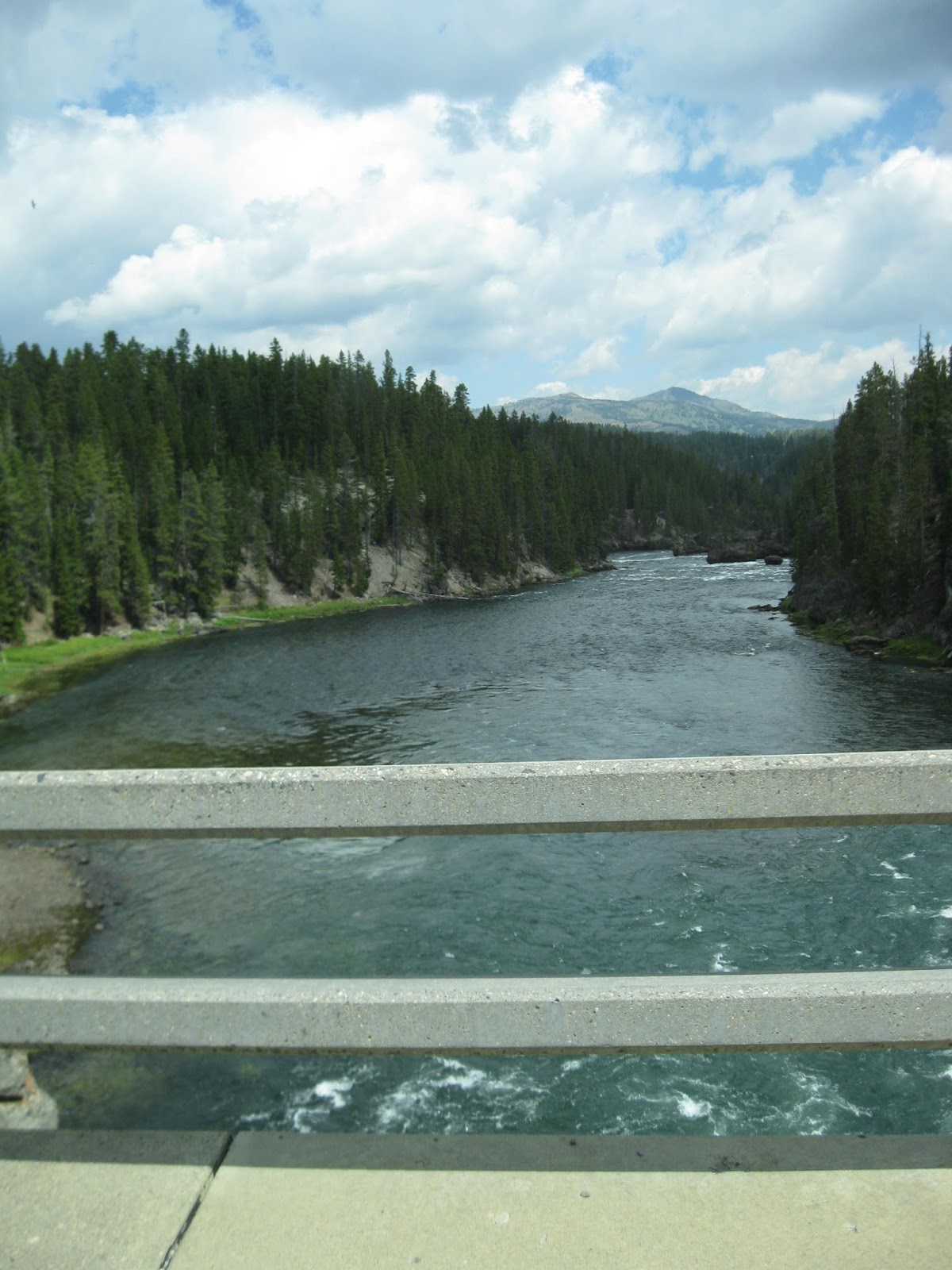
 Yellowstone River


 This Buffalo walked a cross the road in front of us and started rubbing his face in the dirt! "Buffalo Facial"?!?
 Stopped in one of the Gift shops and met this Buffalo.
 Quite a wall!
 Interesting geology
 Yes a petrified tree in Yellowstone!
 A close up of the petrified tree. real interesting. The only problem is, the park service has a very narrow road to it and almost NO parking once you get to it!
That's it for this trip to Yellowstone NP.


Moving on to Rapid City S.D and the Black Hills!


Hwy 16 thru the Bighorn National Forest. Very pretty drive!
Enjoy the ride and the scenery!


Everyone stopped so some cattle could cross the highway!


These the cattle that crossed the highway!


Check the brakes and lets GO!!!

We spent the night at Indian Campground in Buffalo, Wy, A very nice RV park with room spaces and tall mature trees.

Close to the South Dakota state line in the median is a concrete Teepee?
Headed to the Black Hills!

We had reservation at Rushmore Shadows RV Resort, another Resort of Distinction.


Electric hookup mounted on the pine tree!

Here's a better picture of the electric connection.
The first place to go in the Black Hills? Mount Rushmore!

The Mount Rushmore National Monument

A panorama picture of entrance to the monument.

Just outside the Visitors Center

Just outside the Visitors Center

The view just inside the entrance, columns with all the state flags.

Robin at Mt Rushmore.

And me at Mt Rushmore


The money shot!!

There those Old Tourists!!

A fun reflective picture off the windows of the visitors center.

Same shot zoomed in.

And closer!


From the highway leaving!

From the parking lot.


Inside the museum, Some plaster casts of the sculptures.

Some of the machines used to make and repair the tools.


Rock formation that looks like a hand waving!

On the road leaving the monument is a nice side view of George!

Bye George!!
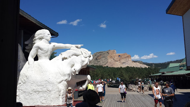
After the major attraction in the Black Hills of Mt Rushmore the next major attraction is Crazyhorse! This monument is realistically close to Mt Rushmore. The biggest difference is that Carzyhorse is privately owned and maintained.


Here's the first view.

A little closer!

 Here's shot of Tourist Robin!


We took a little extended tour on an old school bus closer to the monument.


 This is the old shack of the guy who lived next door to Korczak Ziolkowski. How gave his property to Ziolkowski.


 Some of the original tools used.
 The 'Original' compressor used by Ziolkowski

One of the original Jackhammers!

 Here's a model of the entire complex

 Native American Quilts


 Number of nice Quilts!
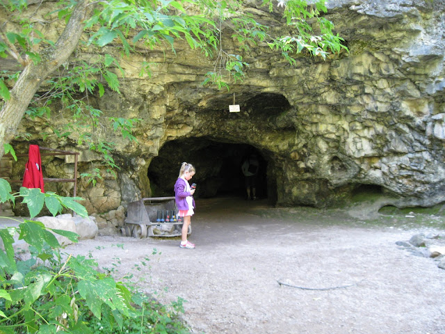
This another privately own attraction close to our RV park.

The entrance.
 The cavern has two parts. The opening on the right is a shallow cave, which was used by native people in the past as shelter from snow. The cavern that is in the tour is to the left, behind a locked door.
 The shallow cave.
 Here's the entrance to the Sitting Bull Cavern.
 Very steep stairway!
 Marks for early workers.

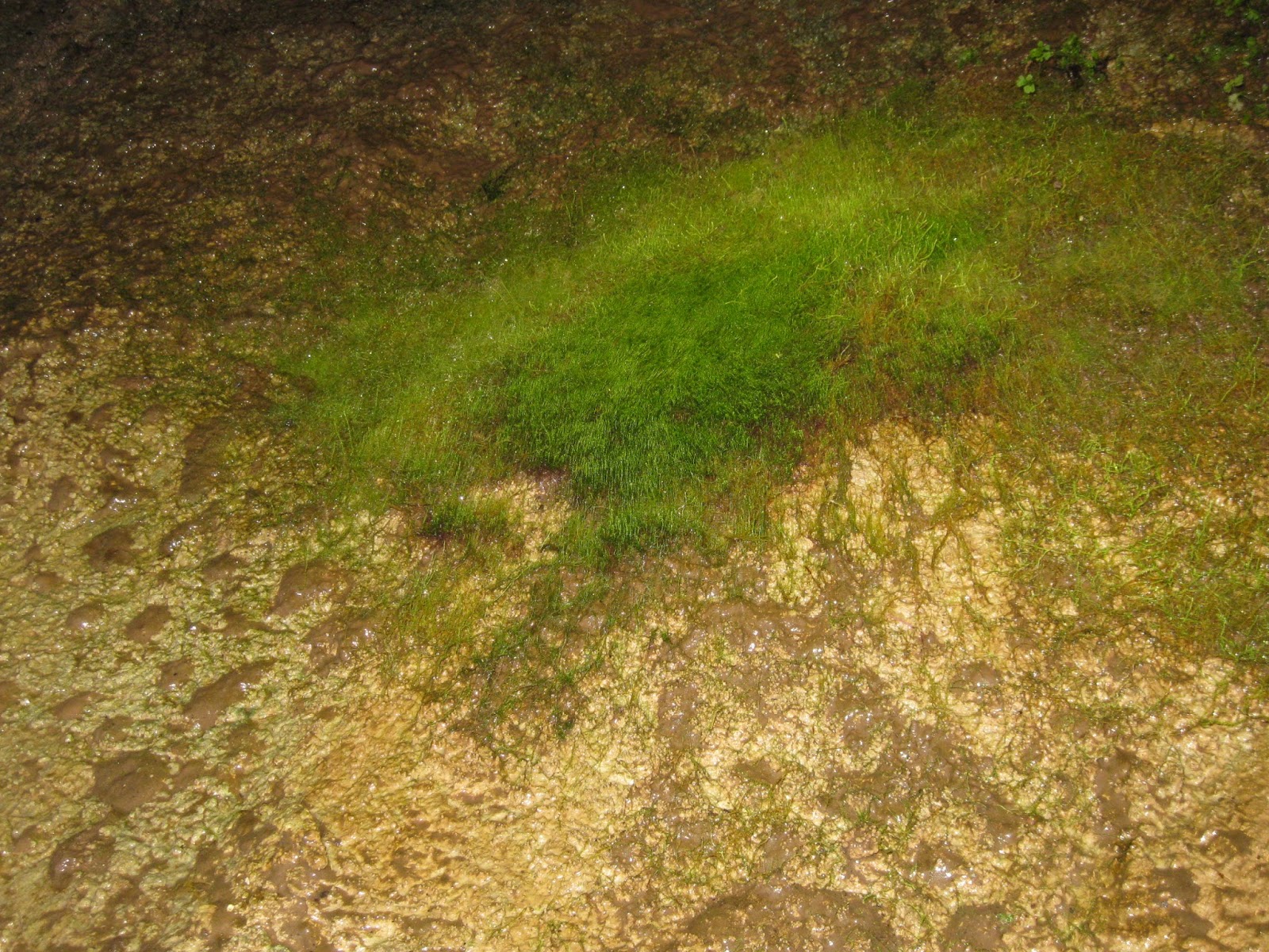
 Actually a type of moss grows in the cave to humans and the flood lights.

 More moss!

 They call this Cave Peanut Butter, but it's watery mineral goo!


 Old marks.

 Cave Bacon!!
 More cave bacon!


 Authentic Railroad station dating back to the 1800.

 All Aboard!
 Look at those Tourists!!
 Nice Train car!!
 Leaving the station!
 Some old cars that a part of the museum.


 Some real homes!
 And a few for sale!!
Part of the train rile-Isn't it neat!!


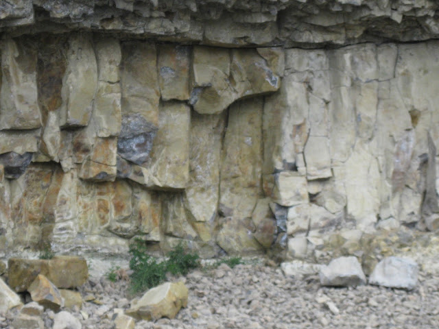
 Nice rock formations.
Pulling into Keystone.


 Downtown Keystone.
 The other side of the street.
 Looking back toward the trail station.
The train is returning!
 There's the engine.

 Another nice place!
 A deer!


 Another place for sale!


 A 'Black Box' for a train.
 The old telegraph office.
 A one person railroad scooter.
 The different size railroad rails.
 And of coarse a model train setup.
 The other end of the model train setup!

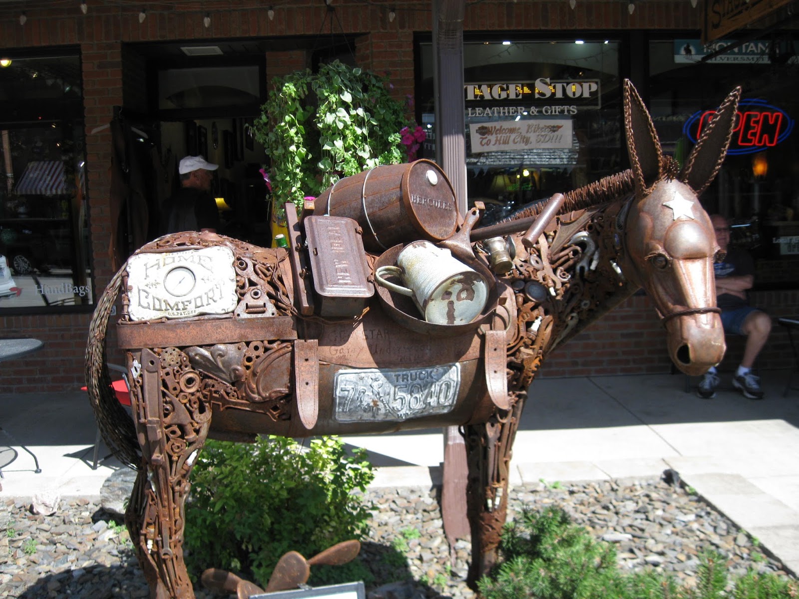
Downtown Hill City, a biker mecca.

Downtown art!

Another fine piece of art work!


 The City Museum
 Nice old sewing machine.


 And a Replica of the Liberty Bell

Panorama shot of the A life size reenactment of the Signing of the Declaration of Independence.
 A life size reenactment of the Signing of the Declaration of Independence.
 Information on the key signers-John Hancock
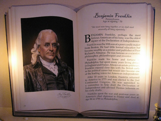 Benjamin Franklin
 Thomas Jefferson
 John Adams
 Samuel Adams


Same bridge from the opposite direction.
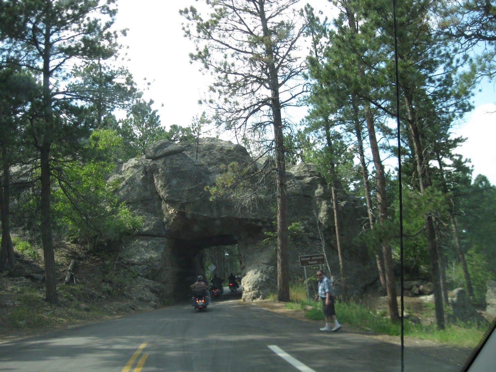
 The main road running through the park is called the Iron Highway.
 This scenic route has a number of tunnel cut into the mountains.

 Is that neat or what?!

 Peek A Boo view of Mt Rushmore!
 A little better view of Mt Rushmore.
 And another, is there a theme here?

 All along the route views of Mt Rushmore.

 Another tunnel.


 Another interesting element of this route are more gluelam bridges!
 So were to raise in elevation.
 Isn't that neat!! Just look at those timbers!
 Divided road!

 End of Divided road!

 Another Tunnel!

 And Mt Rushmore Again!!


 Interesting rock formation.
 And a lot of wide open spaces!!
 The farmers apparently harvest the wild grass in the highway right of way.


 Here's our next stop, Shamrock Saloon, outside of Wheatland Wy.
 Here's our RV spot for a couple days while we visit with Laura.
 Laura's Shamrock Saloon.
 A piece of chain the was around a tree limb and the tree started to grow around it. And someone cut the tree limb off to retrieve the chain. Now it's a decoration in the front of Laura's bar.
 A close-up of the chain.

 Welcome to Colorado, our first since 1995.

Heading toward Denver.
 Right through Downtown Denver!

 Look right in the middle of the freeway, it's Mile High Stadium.


 Our space, one of the better ROD sites we've had.
We had no more and got setup and a thunder storm hits.


A panorama of the Garden of the Gods

Colorado's Geology.

More Colorado Geology.


 A photo from the 1920's
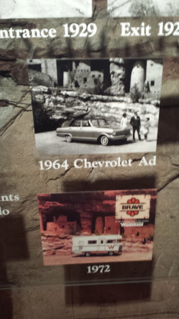
 Photo's of the opening in 1929.


 A panorama view the the cliff dwellings.


 One last shot of Manitou Cliff Dwellings.
 Here's the train station

Loaded and ready to leave.

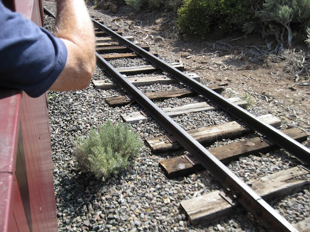
A sample of the cog tracks.
 Another look.

Colorado Springs in the distance.

The power and communication lines.

Lots of boulders


And a pretty good stream.

No water shortage in Colorado.


A crew station from back when the trains were Locomotives.


 Almost to the top!
 Rough terrain!


Looks a little Cold at 14,000+ feet!
 Headed back down.


Passing a train going the opposite direction.

 Looks a little steep!

 Back into the trees.
 A old building that's collapsed!
A video of the sensory!
 An old caretakers house.

 A lake Moraine in the distance.
 A sample of how the cog drive and rail.
 Downtown Manituo
 Nice little town.

 A retired Cog steam engine locomotive.


On to Antonio, Colorado and the Cumbre & Toltec Railroad. Our base camp at Mogote Meadows RV Park.
 Our camping spot.
 Our view.


There's the entrance.

There's the train.

A vintage locomotive!
 The train station
 A panorama view of our train.
 Our Locomotive and coal tender.

The Power Parts!
 The Engine!

Isn't that neat!

The other side!
 The Born On date of our Locomotive.

 Our rail car.
A video of the train we'll be riding!
 Goofy old guy looking at his phone!

 Heading out, leaving the station.
Here's a water tank leaving the station.
 Our railroad car.
 Off into the desert.
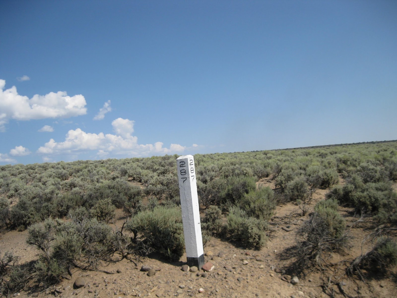
 A mile post, 285 miles to Denver!
 A wooden trestle bridge
 A slight curve.
 Another mile post.
 We're crossing into New Mexico.
 A siding track.
 Another curve.
 A water tank.


 A real nice canyon

 Rugged mountain!


A Video of our train ride.


A video of a Tunnel.
A video exiting the tunnel.

An a couple tunnel.


Passing a group of railroad scoots enthusiast!

 Approching an old railroad station where we'll have lunch.


 Headed toward Chama.

 A curve and bridge ahead.
 This is another old station which is the high point of the ride.


 A cowboy looking for some cattle.
 There's the cow!!


Blowing the steam tank to clean out slag before the last station in Chama, New Mexico.
 There you go! The Land of Enhancement!
 Northern New Mexico has a lot of wide open spaces.
 Looking southeast toward Toas.

 We passed through an area northwest of Toas with some very Unusual homes!!
 I stopped to picture these!
 In the middle of nowhere is this very deep canyon with the Rio Grande river at the bottom.
 Heading south to Santa Fe.
 In a rest stop along the highway, a fellow Lance owners.
 More open highway.


 Only two drive aisles and very narrow spaces. about 3 ft for a yard?!?
 Here's a look at the utility side, which was narrow also and getting to our hookups was very difficult.
 Looking up the main drive aisle. DIRT= DUST!!!
 The way out to the highway.


 More bottles.

 And more bottles!

 And more bottles!
 Model toys

 A bottle Kiva
 Ross Ward sail boat that he sailed around the world in.


 A map of his voyage!
 Pictures of the trip.
 Looking toward the wheel and cabin.


 More antiques.
 Old Tools


 I don't think anyone was left out! An interest side note: there was a sign that warned, you cars remote door locks may not work-guess what-they were right, ours didn't!!
 The Visitor Center / Gift Shop / Snack Shop
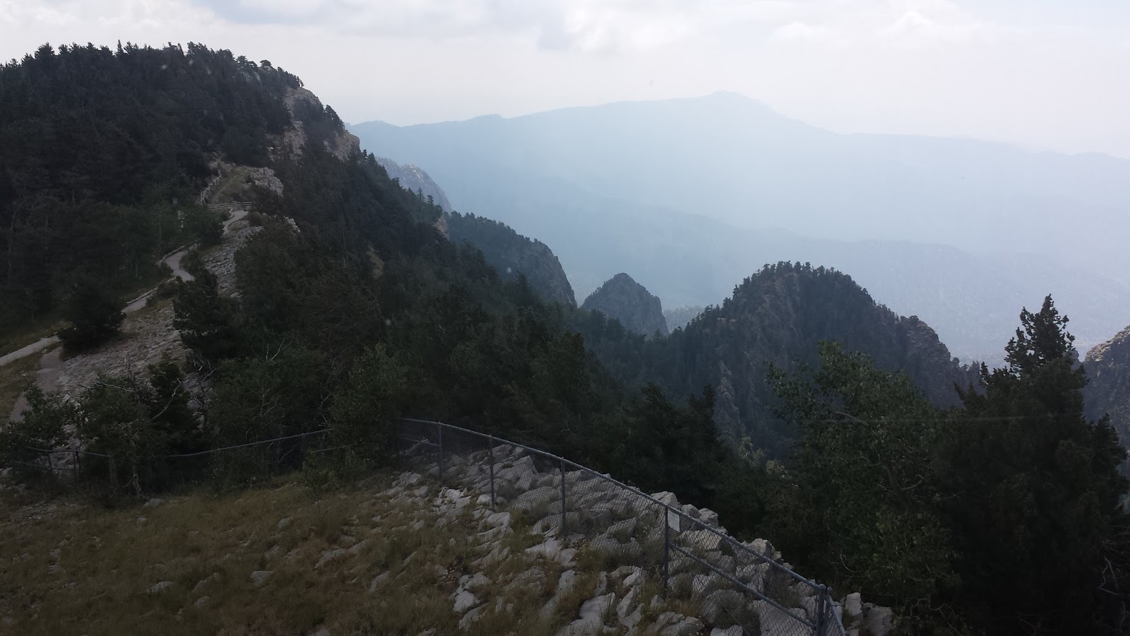
 Some magnificent views of Albuquerque!

The second day the rode an Ariel Tram up the western side of the mountain to the top. There's an excellent observation point and access to the ski lift on the east side.
 Here's the lower end of the tram. At the northeast end of Albuquerque.
 Heading up to the top.
 There's the other car. Most trams have at least two cars to equals the load going up and coming down.


 Kinda hard to see the top end.


 There it is coming into view.
 There's the head works.
 And yes, A Panorama view of the valley below.


 The people who had the vision to build the tram.
 Nice view of Albuquerque.


 There's that other car!


 Coming back to the Mother Ship!
 The meaning behind the New Mexico symbol.
 The machinery!!


All way enjoy seeing the Old an town and Albuquerque has a very nice one.

A Historical Marker commemoration the founding of Albuquerque in 1709!
 Many nice little shops a of coarse a central plaza!
 A nice court yard with shops above and below.

 And another Turista!!
 Shops around the Plaza.
 The Plaza!
 New Mexico Chile's!!
 A Gazebo in the Plaza.

A closeup of the Gazebo!
 And of course a Catholic Church.

 These guys have followed us ever since Roswell?!?
 Our camping spot in Carlsbad in Carlsbad RV Park and Campgrounds
 The other side, not to bad other than All Dirt! Most of our neighbors were oil field workers.
 The Carlsbad Monument Sign.
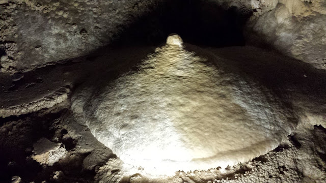
On to the caverns which are 750 feet down and a constant 54* cool. I won't narrate the caverns pictures. Cavern pictures and self explanatory! Enjoy!!


 Walking through the museum we found this guy!!
 Here's a diagram of the caverns.
 And of course a 3D relief map of the caverns.
Outside the cavern entrance is a few tourist gift shop where we found these.
 Fake!!!
 Scary!!
 Off in the distance is the Carlsbad Caverns visitor center on top of the ridge in this picture.
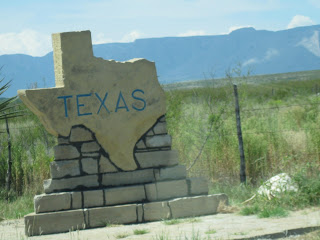 The Texas state line was only 18 miles from the Carlsbad Caverns, so after the caverns we drove over and took this picture so we could say we were in Texas!
 This going down the west side of the mountain.
 Yes, with tunnels!

 Fairly long tunnel.
 A fairly steep down hill grade.
 This is a mobile home park I lived in in 1959!

Another picture, this area is an addition to when I lived here, well after 60 years that's OK!

 The Monument Sign.


 Yes it was WHITE!!! And a little Warm.
 White On White!! Lance Looks great in White.
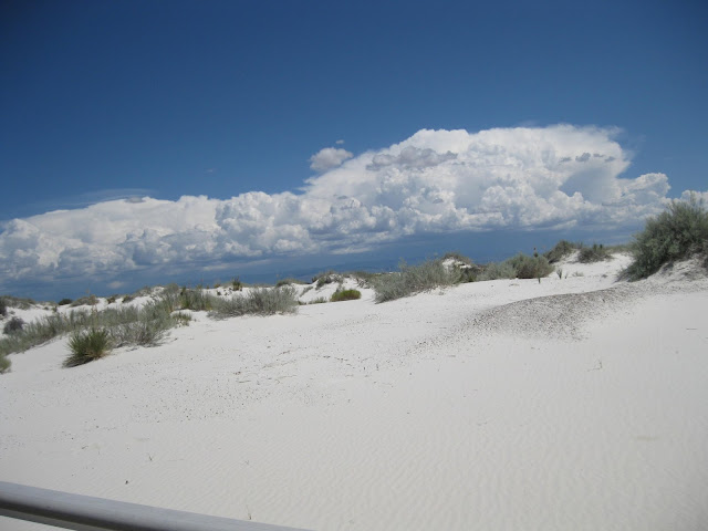 A that sand and no Dune Buggy! (Just Missiles!)


 Here's our RV space in Sunny Acres RV Park. Which is next door to a mobile home park we lived in Angle Mobile Park in 1957.
 Nice wide drive aisles.

 Cabanas and storage sheds, a great place for snowbirds!
We had time while we were here, so I looked up a resturant my folks like to go to. I remembered it as "Old Mesilla"
Well I wasn't to far off the real name is, "La Posta De Mesilla"!!!

Tucked away in an old part of town in an area you wouldn't think of for dinner, unless you know where you're going!
 Nice Ambiance and so big inside!
 Another thing I remember are the birds, my mom loved to talk to them. Now they are in a big cage at the entrance.
 Another bird.

 There is is Arizona!


Crazyhorse Monument!
After the major attraction in the Black Hills of Mt Rushmore the next major attraction is Crazyhorse! This monument is realistically close to Mt Rushmore. The biggest difference is that Carzyhorse is privately owned and maintained.

Here's the first view.

A little closer!


We took a little extended tour on an old school bus closer to the monument.


One of the original Jackhammers!

Here's a nice comparison photo of a model and the real monument.

Here's a portrait of Korczak Ziolkowski.


Sitting Bull Crystal Caverns
This another privately own attraction close to our RV park.

The entrance.


Black Hills Railroad Hill City to Keystone.
On to the Hill City/Keystone vintage train ride!
Here's the Black Hills Railroad located in Hill City, So. Dakota.


An old Locomotive and a few cars.


The train is returning!


Downtown Hill City, a biker mecca.
Downtown art!

Another fine piece of art work!
Custer City
The Custer Chamber of Commerce had a clever with fiberglass Buffalo's!


Another old sewing Machine.
Independence Hall
Very interesting building and attraction in the Black Hills.


Panorama shot of the A life size reenactment of the Signing of the Declaration of Independence.


The is a Gluelam bridge that leads to Mt Rushmore

This one of the more magnificent gluelam bridges in the Black Hills.

After the city of Custer we drove through Custer State Park.


Very nice scenic route!

Our last trip was to Sturgis, after the big motorcycle get together!
Moving on the Wyoming!

There it is, back in Wyoming!!


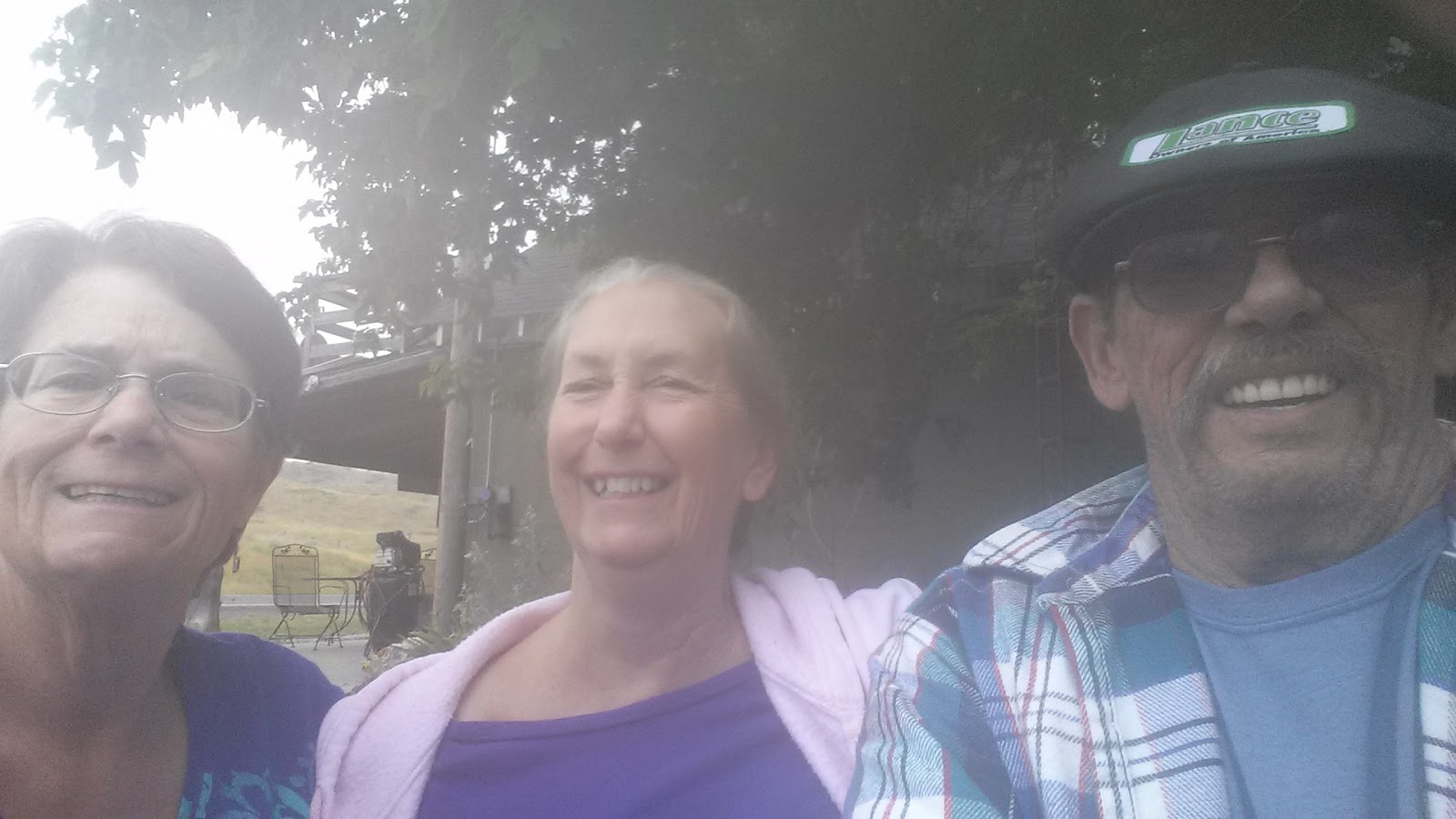
A group selfie I day we were leaving leaving. We had a great visit!!
Headed to Colorado now!


Heading toward Denver.


How close is that?!?
Colorado Springs, Colorado

Our base of operation in Colorado Springs. Colorado Heights Camping Resort, another Resort of Destruction.


Here a screen print from my cellphone regarding the Severe Weather Alert!
Note the Tornado Warning!!
Gardens of the Gods
The Garden of the Gods' red rock formations were created during a geological upheaval along a natural fault line millions of years ago. Archaeological evidence shows that prehistoric people visited Garden of the Gods about 1330 BC. At about 250 BC, Native American people camped in the park; they are believed to have been attracted to wildlife and plant life in the area and used overhangs created by the rocks for shelter. There are many native peoples who have reported a connection to Garden of the Gods, including Apache, Cheyenne, Comanche, Kiowa, Lakota, Pawnee, Shoshone, and Ute people.
Beautiful rock formations in an area northwest of Colorado Springs.

A panorama of the Garden of the Gods

Colorado's Geology.

More Colorado Geology.


Manitou Cliff Dwellings
The Anasazi did not live in the Manitou Springs area, but lived and built their cliff dwellings in the Four Corners area, several hundred miles southwest of Manitou Springs. The Manitou Cliff Dwellings were relocated to their present location in the early 1900s, as a museum, preserve, and tourist attraction. The stones were taken from a collapsed Anasazi site near Cortez in southwest Colorado, shipped by railroad to Manitou Springs, and assembled in their present form as Anasazi-style buildings closely resembling those found in the Four Corners. The project was done with the approval and participation of well-known anthropologist Dr. Edgar Lee Hewett, and Virginia McClurg, founder of the Colorado Cliff Dwelling Association.


Ads shot at Manitou Cliff Dwellings


Indian mobile home!

The Pikes Peak Cog Railroad
The railway was started by Zalmon G. Simmons, inventor and founder of the Simmons Beautyrest Mattress Company. The company was founded in 1889 and limited service to the Halfway House Hotel was started in 1890. The summit was reached the following year.
A number of steam locomotives were built for the line by the Baldwin Locomotive Works, all rack-only locomotives with steeply inclined boilers to keep them level on the average 16% grades. Operating steam locomotives on such a line was back-breaking work and expensive, so when more modern forms of traction became available, the railway was eager to modernize.


Loaded and ready to leave.

A sample of the cog tracks.


Colorado Springs in the distance.

The power and communication lines.

Lots of boulders


And a pretty good stream.

No water shortage in Colorado.


A crew station from back when the trains were Locomotives.


Passing a train going the opposite direction.
A video of the trains passing.


A video of the decent!


Our trip to Antonio
Highway 160 to Antonio, Colorado in south central Colorado.

More beautiful country side.

Another grade to climb.


The old gut checking his phone!


More of our view.

Back to Antonio and the train.

Pretty country!
Cumbre & Toltec Railroad
The Cumbre & Toltec Railroad has been on our 'Want to do' list for a number of years. Unfortunately Antonio Colorado is in an out of the way location, but we made it a point to include it on this trip.
The Cumbres & Toltec Scenic Railroad (C&TS) is a 3 ft (914 mm) narrow gauge heritage railroad running between Chama, New Mexico and Antonito, Colorado. It runs over 10,015 ft (3,053 m) Cumbres Pass and through Toltec Gorge, from which it takes its name. Trains operate from both endpoints and meet at the midpoint. Today, the railroad is the highest and longest narrow gauge steam railroad in the United States with a track length of 64 miles. The train traverses the border between Colorado and New Mexico, crossing back and forth between the two states 11 times. The Cumbres & Toltec Scenic Railroad has been jointly owned by the States of Colorado and New Mexico since 1970 when it was purchased from the Denver and Rio Grande Western Railway, saving it from the scrap yards. The Cumbres & Toltec Scenic Railroad received the Designation of a National Historic Landmark in 2012 by the United States National Park Service.
There's the entrance.

There's the train.

A vintage locomotive!


The Power Parts!


Isn't that neat!

The other side!


Here's a water tank leaving the station.


The Water Tank.


A Video of our train ride.


A video of a Tunnel.
A video exiting the tunnel.


Passing a group of railroad scoots enthusiast!


Heading to New Mexico
We traveling down trough New Mexico to see Carlsbad Caverns. Along the way we traveled through Toas and Santa Fe. I had lived in these city many years back, as a child. This is partly seismic see and a chance to visit old memories.


So cattle off in the distance.
Next stop Albuquerque. Just a few days of sight see in another town I used to live in. We had reservations at Hidden Valley Resort a little east of downtown Albuquerque. It's another Resort of Distinction affiliate. Have to say, it had to be the very worst ROD park we have ever stayed in.

Here's their sign.


On our way to get gas in down town Albq. I spotted this Smog Station for my friend Butch!
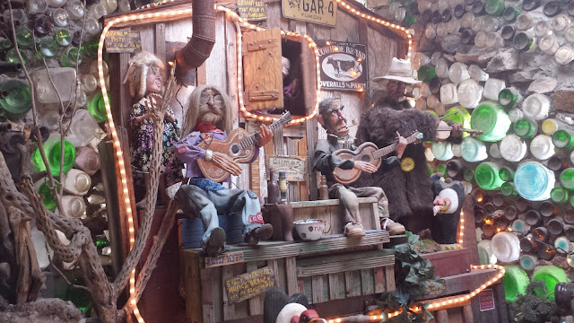
Some sight seeing around Albuquerque, so the first stop was world famous Tinkertown.
Tinkertown is open daily from April 1 to November 1 & located on the Turquoise Trail on the road to Sandia Crest.
Tinkertown Museum is a folk art museum created over 40 years ago by the late Ross Ward (1940-2002), His miniature wood-carved figures are showcased in Tinkertown Museum including a 1880's miniature animated western town & three-ring circus.
What was once a four-room summer cabin has been transformed into a 22-room legacy showcasing the genius of one man's life work. The construction utilizes over 50,000 glass bottles & other available recycled materials to display animated miniature western town, circus, saddle show & much more.

What a collection.


Bottle wall.


That's it! Tinkertown!!
On to Sandia Mountain.
Sandia Peak is located in the Sandia Mountains. Sandia Peak is 10,375 feet in height. It is a a unique mountain peak on the east side of Albuquerque. You can get to the top from both the east and west sides. We did both on two different days. On the the first day we drove up the east side. Which takes you to ALL the communications towers in New Mexico!!


The second day the rode an Ariel Tram up the western side of the mountain to the top. There's an excellent observation point and access to the ski lift on the east side.


Some more interesting geology!

A Historical Marker commemoration the founding of Albuquerque in 1709!


Hows this for a Turista!! O'Lay


A closeup of the Gazebo!


And the front of the Catholic Church
Moving on to Carlsbad, New Mexico and Carlsbad Caverns.


On to the caverns which are 750 feet down and a constant 54* cool. I won't narrate the caverns pictures. Cavern pictures and self explanatory! Enjoy!!


Outside the cavern entrance is a few tourist gift shop where we found these.


After Carlsbad we have to start home now :(
To make the trip home somewhat interesting, I chose a course through some towns and areas where I lived as a child. We traveled back up to Artesa NM and then west to Alamogordo, NM. It's a very scenic drive with some very beautiful mountain passes.


Another picture, this area is an addition to when I lived here, well after 60 years that's OK!

Here a picture from the main highway. Shade Grove RV Park.
After Alamogordo we traveled through White Sand National Monument (and proving grounds!)


OUPS forgot something!!!
Moving onto Las Cruses, New Mexico.


A Stop and Go in Organ, NM a small wide spot in 1957, but not now. Almost part of Las Cruses.

This how close Las Cruses is now! Used to be a long ride on a school bus!

Traveling down the highway to Las Cruses, checkout the off ramp ahead!! "Porter Dr."
On into Las Cruses!
More traveling down memory lane!


We had time while we were here, so I looked up a resturant my folks like to go to. I remembered it as "Old Mesilla"
Well I wasn't to far off the real name is, "La Posta De Mesilla"!!!

Tucked away in an old part of town in an area you wouldn't think of for dinner, unless you know where you're going!


Main street to the La Posta De Mesilla restaurant "Speed Humps" OMG!!!
Heading on the Arizona.
We had a reservation in Benson at a ROD resort, but they had to close the park the 1st of August so we had to find someplace else. The temperatures in AZ in late August in the low 100's we decided to travel as far as we could to lessen the heat.


We ended up at Crazy Horse RV Park just south of Tucson.

Hey, they were close to the freeway and they had electricity!
We had hoped to stop in Phoenix and visit with our Lance friends Al & Betty, but just before we got there Betty had a mishap and was under the weather, so we spent the night in Phoenix and hit the road early the next morning for Home!
We had a Great 2 month, 7014 mile and 12 state trip!
2015 Trip to Lake Skinner Temecula, CA.
A short weekend trip the Lake Skinner for a wedding in Temecula
Here out camp site. Lake Skinner RV park has an odd space layout pattern. The have mast paired spaces that face the adjacent space. This is very nice if you and another family camp together, but if you are alone you get very cozy with get acquainted setup.
.jpg) We weren't aware when we made our reservation that Temecula Fair was the same weekend and the carnival was right behind our camp site!!!
We weren't aware when we made our reservation that Temecula Fair was the same weekend and the carnival was right behind our camp site!!!
.jpg)

2015 Trip to Quartzsite, AZ.
Our annual pilgrimage to Quartzsite
 Waiting by Bob's Big Boy for Joy and Butch.

 Our usual spot at the Quartzsite BLM camping area.
 Joy and Butch's New for them motorhome.
 Lulu soaking up the sun.
 Widget wanting out of the pen.
 Lulu just enjoying the great weather.
 My broken tail light lens.
 See the missing pieces in the lower corner.
 Nothing like a nice warm camp fire!

A total restores 1972 Winnebago motoprhome.
2014 Trip to Las Vegas
Freemont Street


Bill O'Reilly and Dennis Miller Show at Caesars Palace

We're in the 'Nose bleed section'!!!
.jpg) Dennis Miller and Bill O'Reilly, Bolder Fresher Show at Caesars Palace.
Dennis Miller and Bill O'Reilly, Bolder Fresher Show at Caesars Palace.
2014 Trip to Solvang and Buellton, CA.
Downtown Solvang.


A very quaint town.


Now we're into some bikes I recognize and have owned!!


A CB750, I've owned two of these!


2014 Trip to Julian, and Lake Cuyamaca, CA.


2014 Trip to Sedona AZ., Flagstaff, AZ. and Williams, AZ.
Sedona AZ. and Oak Creek Canyon the first leg of our trip.
Ready for our second big trip of the year!!

Our Rv space in north Phoenix AZ.


Rancho Sedona Rv Park


.jpg)


.jpg)
.jpg)
%2B(1).jpg)
%2B(1).jpg)
%2B(1).jpg)
.jpg)
.jpg)
.jpg)
Oak Creek Canyon


Down there is a very nasty road to tow a travel trailer up or down!


On to Flagstaff, AZ.
Flagstaff KOA has real Teepees

And old phone booths that don't have phones!!

Our shade little spot

Joy & Butches spot


A Day at Williams, AZ.


.jpg)


The long trip home!!

Slide Check-Looks nice and tight!!

Quartzsite Night Lites!

Lunch at beautiful Chiriaco Summit!
 And on home and the end of another Great Trip!!
2014 Trip to Fresno, CA., Jackson, CA., Bass Lake, Ca. and Yosemite Valley, Ca.
- Forestiere Underground Gardens Located at 5021 West Shaw Avenue in Fresno, California are an unusual man made creation built by Baldasare Forestiere, an immigrant from Sicily, over a period of 40 years from 1906 to until his death in 1946


Jackson Rancheria RV Resort in Jackson, CA.
Here's the entrance to to luxury RV Resort.

Charles and Jeannette's Dinner in the Orchard.


After a Great Dinner we watched a Classic Movie under the stars.


Bass Lake RV Resort, Bass Lake, CA.


A nice Bass Lake cove a short walk from the RV Park.


Yosemite Sugar Pine Railroad


- Yosemite National Park, CA.


2014 Trips to Mountain Lakes, in Lytle Creek, Ca.
Here's pictures of our June 2014 trip to Mt Lakes for a little fishing!


Waiting for the truck to stock the Catfish pond.


Beautiful pond!

A fishing pier, real nice but crowded.

Well, the truck just dropped 2000 lbs of Catfish but we have to wait a couple hours before we can fish.

Here's pictures of our May 2014 trip to Mt Lakes with Isaac.

Our camping spot 607 for this trip. A little tight but close to water so Isaac can fist.

Grandma and grandson fishin' at the pond!

Isaac is sticking with it!

Lets see that fishin' Face!!!
2014 Trip to Truck Haven/ Salton Sea, Ca.


Oupps we rolled our Samurai!!! Not to much damage, a lot less than I would have expected.


2013 Trip to Lake Cuyumaca/ Julian, Ca.
Our annual trip with Joy and Butch the San Diego high country of Julian, Ca. Once a stop on the overland stagecoach trail from points east to San Diego. No a quiet tourist town with a free surrounding farmers supplying apples.


2013 Trip to Sedona, Flagstaff and Williams, Az.
This trip was going to be a two week trip and we are traveling with our long time friends, Joy and Butch. Butch's brother is getting married in Sedona, Az. and they wanteds to travel along and see some parts of Arizona we hadn't seen or hadn't seen in a long time. The itinerary was to take two days to get to Sedona. Because we could leave earlier we pushed onto Phoenix the first day, leaving a short trip the next day to Sedona. Joy and Butch left later in the day and made it to Quartzsite, which made for a longer second day.


Rancho Sedona RV Park


Our new Satellite Dish, more compact than our old original, but just as much work to setup!!
 Our camping spot. Real nice RV park in the middle of Sedona, AZ. But it's expensive and Rules out the wazoo!

Tlaquepaque Art and Craft Village

Fountain in front of a Tlaquepaque Art and Craft Village


The Red Rock mountains around Sedona.


.jpg)


.jpg)
.jpg)
.jpg)
.jpg)
.jpg)
.jpg)
.jpg)
.jpg)
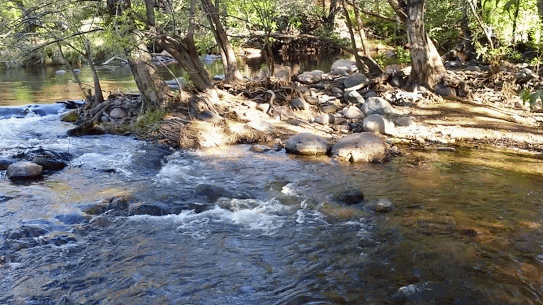
Here's some pictures and videos of the creek near our campgrounds.


A friend told me about this so we had to check it out! A McDonalds sign where the Golden Arches are Green!!

Is there any other way to Fish?
Driving to the famous Oak Creek Canyon!


Two Tectonic Plates moving in opposite direction have created this geological formation.


You can't appreciate this section of road (89A) until you tow a trailer up it!!


Shut you mouth Bob!!


An a panorama picture!


Weird seeds on this bush.


Not one but TWO phone booths!!

Superman and Superwoman!!


Look at those ears! Wow

A Zipline or seat in downtown Williams AZ.

With a vintage 57 Chevy sign over it.
Downtown Williams is a 60's museum


The kids are tired from a long day at Williams, Az.

Our camping spot at the Flagstaff KOA.

Longer shot of more of our spot.

The drive aisle in front of our space.

Joy and Butch's camping spot.

Camp Verde, Az. for lunch. busy place!!!

Just double checking the slide to make sure is staying put.

Sunset in Quartzsite, Az. at our favorite BLM campground on our way home.

Last stop before we return home, lunch at Chinaca Summit, just east of Indio, Ca. at the top of Chinaca grade.
Subscribe to:
Posts (Atom)